Indigenous population: driven out or drawn into the labour force
By the time that Britain established a formal colony at the Cape in 1806, Dutch farmers had taken control over much of the land in the western part of the country. Dutch control affected the lives of the indigenous San hunter-gatherers and Khoi herders. Dutch settlers killed San livestock which the San needed to survive and many of the San were also killed by the Dutch settlers. Those San who survived moved to the dry regions of the Great Karoo. The San were raided by Boer commandos, who killed the men and captured the children and women as cheap labour sources to work on farms.
The Khoi lost grazing land and their independence to Dutch settlers. Many of the Khoi went to work as herders or servants on Dutch farms. The Khoi herders and servants were treated badly and paid unsuitably. A few slaves and herders escaped Dutch farms and became refugees beyond the borders of the colony. In January 1799 in the eastern Cape, there was a major uprising when Khoi and San servants left the farms and joined the Xhosa in a rebellion against colonial rule, commonly known as the Third Frontier War (1799-1803). These Khoi ex-servants rebelled against colonial rule and wanted to repossess the land where their ancestors once lived. The Khoi joined the Xhosas at the Zuurveld and attacked Dutch farms, reaching as far as Oudsthoorn by July 1799. The British decided to send troops to crush these uprisings.
Once British colonial authorities took control of the Cape, they introduced various new policies to settle disputes over land. Firstly the British unsuccessfully attempted to settle the San on mission stations where the San would have control over their own livestock. This policy failed, because the San led a nomadic lifestyle and did not want to become settled farmers. In addition, the San did not want to convert to Christianity, therefore many of them ran away. Secondly, the British set aside a reserve between the north of the colony and the Gariep River (now known as the Orange River), which the British called Bushmanland. Even though settlers were not meant to go to this reserve, some ignored the regulations and hunted the animals which the San relied on for their livelihood. The British had different policies for the Khoi.
Firstly in 1809, the British introduced a law called the Caledon Code. According to the Caledon Code, if a Khoi person wanted to work on another farm or move to a new district than he/she had to carry a pass – an official document which allowed a Khoi to work or live on a new farm or in a new area. In 1828 the British replaced the Caledon Code with a new law called Ordinance 50. Ordinance 50 allowed the Khoi to move freely and the British wanted them to work on new wool farms in the eastern Cape. The British colonial authorities hoped that Ordinance 50 would motivate Khoi farmworkers to set up their own farms by increasing the productivity of the labouring class in order to stimulate the Cape’s economy.
However, Ordinance 50 did not result in significant changes to the lives of Khoi workers as the Khoi did not have capital or land in order to set up farms. In 1829 in the eastern Cape, the Kat River settlement was setup by the British as a reserve for Khoi farmers. The Kat River settlement was established with the expulsion of Rharhabe Xhosas. The settlement was intended as a buffer zone to prevent conflict between the British and Xhosa. Hence the inhabitants of the Kat River settlement were armed by the colonial government despite objections by White settlers.
400 Khoi persons settled on the reserve and at first the farms were prosperous. With the support of missionaries, the settlement soon developed into a self-sufficient and prosperous farming community. However as a result of wars between the British and Xhosa in the settlement, by the 1840s the hard labour of the once prosperous farms was destroyed.
Changing labour patterns: Ending of the slave trade (1807) and slavery (1834) at the Cape and control of labour
In the late eighteenth century, anti-slavery sentiments in Britain grew as more people became aware of the immorality of slavery. In 1807 the British parliament passed the Abolition of Slavery Act, outlawing the slave trade throughout the British Empire, but not the ownership of slaves. Therefore at the Cape new slaves could not be bought, but the slaves already owned could be kept. In 1808, the first mass movement against slavery at the Cape occurred on farms just outside of city of Cape Town. Influenced by the news of the successful slave revolt in Haiti (1804), 300 slaves and Khoi workers planned to gather slaves and march to Cape Town and forcibly demand that all slaves are granted freedom.
However, news of the revolt reached the Governor of the Cape, who ordered a cavalry and infantry to lay and wait for insurrections at Salt River, just outside of the city. The marchers were captured and organisers of the protest were hanged; and participants were jailed on Robben Island. In the 1820s, new laws were passed which improved working and living conditions of slaves. In 1823 a law was implemented, to improve the working conditions of slaves, and stipulated the maximum working hours, maximum punishments, and standards of food and clothing provided to slaves.
In 1826 a policy was created, allowing slaves to buy their own freedom. Those slaves who could afford to, received a basic education. Due to these developments which improved the lives of slaves, many slaves felt more confident to large complaints to Cape authorities of mistreatments they suffered under their masters. In 1834, slavery was abolished throughout the British Empire and slave owners at the Cape were against the abolishment, but accepted it due to the colonial authorities’ promise of compensation. Many slave owners were angered, because they did not receive the promised compensation.
Despite the fact that slavery was abolished in 1834, slaves still had to work on farms for another four years without pay as apprentices in order to assist employers and farm owners in the transition to the new system of wage labour. Once slaves were freed they had no money or land and most continued as to work for low wages as unskilled workers. Therefore they continued to be the poorest members of society in the Cape.
A poster advertising the sale of slaves in addition to muslins, rice and books By the time of Britain’s colonial rule at the Cape in the early nineteenth century, Britain was the world’s leading commercial and industrial power. British traders and merchants established businesses in Cape Town, which imported manufactured goods from Asia and Britain. The imported manufactured goods comprised mainly of textiles, clothing, machinery, crockery and furniture. The Cape’s main export was wine. Cape Town began to develop as a vital commercial centre.
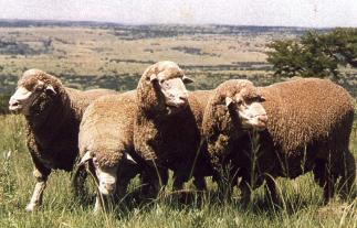 Merino sheep, a breed that led to the wool boom at the Cape. Image source
After the Napoleonic Wars (1803-1815), unemployment became a serious issue in Britain and the British government’s solution to this issue was to encourage citizens to immigrate to the Cape to find work. Therefore in 1820 the British government sent approximately 4000 new British immigrants to settle in the eastern Cape. Referred to as the 1820 settlers, the new immigrants were granted farming land to settle on in the village of Bathurst in the eastern Cape. Most of the farms were unsuccessful, because most of the immigrants were artisans who lacked agricultural experience. In search of a better life, many of these immigrants moved to the newly established towns of Port Elizabeth, Grahamstown and East London.
Those who remained on the farms became quite successful in farming barley, maize and rye; and they also became quite wealthy due to the introduction of the merino sheep in South Africa. Although already introduced in the Cape in 1795, it was only in the 1830s that Merino sheep became more widespread throughout settler farming communities. The indigenous sheep were called the Cape sheep (or Kaapse skaap) and did not produce a fine wool quality. Merino sheep produced excellent wool and the demand for wool in Britain’s textile industry led to a wool boom at the Cape. The economy of the central and eastern Cape was transformed as a result of the commercial wool industry and wool replaced wine as the Cape’s most important export.
Due to the success of the wool farmers, they wanted more land to further expand their wealth. The farmers asked the government to cede control of more Xhosa land for farming land. British merchants and traders started to sell their goods in areas other than the Cape, made possible by the establishment of a British colonial coastal settlement of Port Natal in 1834. The area of Port Natal (renamed Durban in 1835) was land given to the British Colony by King Shaka Zulu.
Boer response to British control: trekking into the interior
The British colony’s expansion and policies did not provide beneficial trading and commercial opportunities for the Dutch colonial settlers. In 1836 approximately 15 000 Dutch-speaking colonists moved from the eastern Cape, but represented only a fraction Dutch-speaking inhabitants of the colony. This mass migration is referred to as the Great Trek (1835-1846) and the migraters are referred to as trekkers or Voortrekkers. The trekkers were dissatisfied with Ordinance 50 which recognised the abolition of slavery, the rights of Khoi and the use of the English as the official language of law and administration in the Cape. They wanted to be free from British control and to form an independent state to advance their own administrative, agricultural and economic interests.
The trekkers moved inland into land which was affected by the Mfecane. The trekkers set up their first base near Thaba Nchu – inhabited by the Rolong, under Chief Moroka, who were closely aligned with the trekkers. The Voortrekkers first major confrontation was with the Ndebele group led by Mzilikazi in 1836. The Ndebele were in the path of the Voortrekkers expedition. Under the directive of Andries Hendrik Potgieter, the trekkers attacked the Ndebele group. The Voortrekkers won the battle against the Ndebele warriors and the Ndebele moved north of Limpopo. A group of trekkers led by Piet Retief split from the new trekker settlement in the interior and went on route to Port Natal.
Along the way they encountered an area dominated by the Zulu under Chief Dingane. A fierce battle between the Zulu and the Voortrekkers then occurred on the Ncume River referred to as The Battle of Blood River. The Voortrekkers had the advantage of guns, resulting in the death of approximately 3000 Zulus. Three Voortrekkers were wounded and there were no Voortrekker casualties. After the Battle of Blood River, the Voortrekkers settled in the area of Natal.
Xhosa responses: co-operation and conflict, including the Cattle Killing
During Britain’s colonial conquest of the Cape in 1795 there had already been two major Dutch-Xhosa wars known as the First Frontier War (1799-1781) and the Second Frontier War (1789-1793). Both the Xhosa and Dutch were cattle farmers and competed for grazing land. There were a total of nine Frontier Wars where conflict involving the Dutch, British, Xhosa and Khoi occurred intermittently over 100 years. These wars were mainly as a result of colonial expansion which dispossessed Xhosa and Khoi people of their cattle and land. The British became involved in the Third Frontier War (1799-1803) when they sent British troops to crush a Khoi and Xhosa revolt in March of 1799 in Graaf-Reniet, eastern Cape.
During the Third Frontier War, the colonial administration feared a Khoi uprising and in order to make peace they allowed the Xhosa to remain on the Zuurveld in Graaf-Reniet. There was peaceful cooperation between Dutch and Xhosa groups, for example Dutch missionaries set up mission stations and schools among the Xhosa. There were some Xhosa who worked as cattle herders on settler farms, in return for copper, iron and tobacco.
In 1809 on behalf of the colonial administration at the Cape, Colonel Richard Collins travelled to the eastern Cape to conduct a report on the conditions in the area. Collin’s report suggested three major proposals including that Africans and Whites should have no interaction until Whites became dominant in the region; the Xhosas should be driven out of the Zuurveld; and at least 6000 Europeans should be settled along the Fish River to form a protective barrier against potential Xhosa incursions. Based on these suggestions, in 1811 British Troops and the Cape Regiment – this consisted of Khoi recruits who fought on the side of the settlers – were sent to the Zuurveld undertaking a brutal and ruthless campaign unlike previous frontier wars. Xhosa villages were burnt, corn and other crops were destroyed and livestock was confiscated.
This Fourth Frontier War (1811-1812) came to an end in 1812 when colonial forces drove about 20 000 Xhosas out of the Zuurveld, east of the Fish River. After the Fourth Frontier War, a line of frontier forts were built in order to hold the frontier. However, the reports suggestion of European or White settlement in the Zuurveld did not materialise and subsequently in 1817 the then Governor of the Cape, Sir Charles Somerset made a verbal peace agreement with Xhosa Chief Ngqika eventually led to the which led to the Fifth Frontier War (1818-1819). In this agreement, Ngqika agreed to stop stealing cattle from White settlers and was forced to cede territory between the Fish River and the Keiskama to the Cape administration.
In return colonial authorities recognised Ngqika as the official sovereign of the Xhosa. Ngqika and his uncle, Ndlambe, were in conflict over rule as chief of the Xhosa clan. Ngqika’s agreement to cede territory to the colonial authorities angered Xhosas. Subsequent to the agreement, Ndlambe led the slaughter of hundreds of Ngqika’s men at Amalinde, but Ndlambe retreated after Boers volunteered to fight off Ndlambe. Then in 1819, the Xhosa united and Ndlambe led an attack, of 6000 men, on Grahamstown. Ndlambe’s army armed with spears was unsuccessful as he was met with British troops armed with muskets. About 1000 of Ndlambe’s men died whereas 3 British soldiers died.
Cattle Killing
By 1856 eight Frontier Wars had been fought over more than eighty years of intermittent battles and in that year a movement began which is known as the Xhosa Cattle Killing Movement (1856-1857). Nongqawuse was a Xhosa girl who claimed to receive messages from spirits, near the Gxarha River, that the whole Xhosa community will rise from the dead and that all the Xhosas cattle were contaminated by witchcraft so the cattle needed to be slaughtered and crops had to be destroyed. Nongqawuse claimed that the spirits promised that if the tasks of the message were carried out then it would have led to greater wealth for the Xhosa.
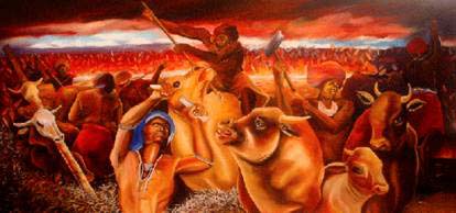 A painting by Andrew Hlangwini from the series called ‘The prophecy of the Cattle Killing of 1856/7 known as the Ibali lika Nongwaquse Image source
She passed the message on to her uncle and the message became the potent prophecy central to the Movement. Many of the Xhosas believed her prophecy and carried out the spirits’ suggestions which resulted in a tragedy for the Xhosa people. Approximately 400 000 cattle were killed which led a famine where about 50 000 people died of starvation. Some Xhosas believed that it was the colonial authorities who were responsible for spreading the story, but there is no evidence to support this belief. By denying help to the starving Xhosa people unless they came to work in the colony, the colonial officials made the situation worse.
Under these circumstances, thousands went to work for the Cape Colony as labourers. The colonial authorities imprisoned some of the Xhosa chiefs and took over more Xhosa land. Thus the Xhosa lost their independence as all their land became controlled by the British.
The Zulu kingdom and the colony of Natal
By 1840, there were two groups of White settlers in Natal (part of what is now known as Kwa-Zulu Natal). There were the British traders at Port Natal (or Durban as it was called since 1835) and trekkers who defeated Dingane at Ncome River in 1838. The trekkers had taken over some of the land and set up a Boer republic in an area which had been part of the Zulu Kingdom. However, the British did not want an independent trekker republic in the area as they feared that it would disturb trade through Port Natal. Port Natal was of strategic importance as it contained a port which was a gateway to the centre of the British Empire, namely India.
In 1843 the British took over the area as an official British colony and named it Natal. The trekkers were opposed to the establishment of the British colony in the area, thus many of the trekkers moved away into the Highveld where other trekkers were settled. The British allowed for the immigration of British people to live in Natal. Most of the settlers in Natal were from Britain, but some people were also brought from Mauritius and Germany.
The need for a controlled labour force: indentured Indian labourers (sugar); also labourers for railways and coal
In order to develop the economy in Natal, the British tried to grow different crops which could be exported. They tried to grow coffee, tobacco and cotton, but this was unsuccessful. In 1851 they first produced sugar. In Natal sugar grew in abundance near the coastline where rainfall levels were high. In order to set up sugar plantations a lot of labour was needed. Local Africans were not prepared to work on sugar farms for different reasons. The Zulu kingdom was ruled by a regiment system which did not want young men to be working on settler farms in Natal, but wanted them to stay in Zululand to farm.
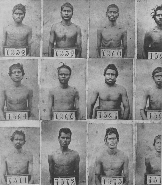 A roster showing photos of newly arrived Indian labourers in Port Natal. Image source
Many Africans themselves preferred to grow their own crops instead of working for settler farmers. After the discovery of diamonds in Kimberley in 1867, men would rather work on the mines for higher wages. Hence the Natal government decided to bring unemployed people from India to work on farms in Natal. Between 1860 and 1911 people from India migrated to Natal by the British colony. They were indentured labourers as they had to sign a contract stating that they would work on the sugar farms for three years (later amended to five years) in return for the cost of their journey from India to Natal.
Once the three or five years were completed, the labourers could decide to remain in Natal or return to India. On arrival in Natal, the labourers were inspected and if they were sickly or too old they were sent back to India. Those who were fit to work were sent to farms. Labourers were not subject to master and servant ordinance, but special regulations of the British colony meant that employers were forced to provide food and lodging, clothing and necessary medical conditions. The employer had to pay ten shillings a month for the first year, followed by an annual increase. However, the labourers still lived in poor working conditions. They were housed in cheap buildings made of corrugated iron or grass huts.
The work was strenuous, difficult and workers were paid very little. Despite long working hours, the workers did not have to work on weekends. The indentured labour package was not appealing, but increased poverty in India made Indians desperate in an attempt to secure survival. The indentured labourers were mainly Hindus, but there were some Muslims. There were also women who worked on plantations.
Many of the Indian woman labourers married fellow male labourers, but due to the low wages and the strenuous work on farms it was very difficult to have a family life. Not only did women have the responsibility of working on the farm, but they also had to cook food for their households, work and look after their children. It was common for married couples to shared homes with other workers.
Not all the Indian migrants worked on sugar farms, but some had other jobs in the colony. The Natal Railway Company used indentured labourers to build railways. Railways were used to transport sugar outside of Port Natal (or Durban) for trading purposes. Large scale coalmining began in 1889 in Natal which led to an increased demand of labour. Mine labour was not popular amongst Indian immigrants, despite the fact that the wages were slightly higher than that provided in farming. However, mining companies were able to employ a sufficient amount of Indian labourers and between 1898 and 1908, the proportion of Indian labour on the mines averaged 38%.
Not all Indians came to Natal as indentured labourers, but some came on business as wealthy traders or merchants. They were referred to as Arabs or ‘passengers’ as they paid for their own trips to Natal. Most of the traders or merchants were Muslims who came from the state of Gujarat. They set up profitable businesses, trading goods between Natal, India and other parts of the Indian Ocean.
The Anglo-Zulu wars
During the second half of the nineteenth century, the British increasingly wanted domination over African societies in southern Africa. By the 1870s an independent Zulu kingdom, known as Zululand, was still in existence and it was located above the British colony of Natal. The British didnot want an independent Zululand to exist and wanted to bring Africans under firm political control. Thereby they would be able to please British settler communities as the control of Africans would allow for a source of cheap labour. The British would be able to expand the colony of Natal
In addition, after the discovery of diamonds in Kimberly in 1867, there was an increasing demand for mine labour. In 1879 the British deliberately stirred up conflict with Cetshwayo as they accused him of planning war and demanded that the Zulu army be disbanded. However, Cetshwayo was not willing to succumb to the demands of the British colony. The main objective of the British forces was to gain control of Ulundi, the royal Zulu kraal (meaning an African village enclosed by a fence).
In January 1879 the British colonial army invaded Zululand, setting off the Battle of Isandlwana, the first major encounter of the Anglo-Zulu War. The Battle of Isandlwana was won by the Zulus after about 1800 British soldiers were met by 20 000 Zulu soldiers. In successive battles, the British had the upper hand with the superior weaponry of rifles. After the Battle of Isandlwana, Cetshwayo tried to make peace agreements with the British, yet the British ignored these attempts. There were a total of eight battles between the Zulus and the British colonial army.
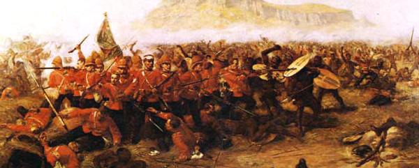 The Battle of Isandlwana (1879) Image source
At the final battle, the Battle of Ulundi, the British destroyed the Zulu capital and captured Cetshwayo. In order to destroy Zulu independence and exercise control, the British divided the Zulu kingdom into thirteen separate chiefdoms, each with a Zulu chief who was loyal to the British. The Zulus were forced to pay taxes which meant that they were forced to work on mines or settler farms to earn money to pay taxes. However, Zulus were angered by British colonial domination and a civil war broke out in 1883.
In order to bring order to the region, the British allowed Cetshwayo to rule once again. Despites Cetshwayo’s renewed rule, the war continued in Zululand. Cetshwayo died in 1884. Zululand continued to weaken as the conflict continued until the Zululand was annexed by the British in 1887.
Co-operation and conflict on the Highveld
In the 1830s there were about 15 000 Dutch farmers, referred to as trekkers, who left the Cape Colony to escape British colonial control. This expedition is known as the Great Trek. Once the trekkers migrated to areas in the interior, they set up their own independent states referred to as Boer Republics. One of the states was set up between the Orange and Vaal River which became known as the Orange Free State. Another independent state was set up north of the Vaal River and became known as the Transvaal.
The trekkers who settled north of the Vaal lived alongside Tswana farmers on land which was not utilised by the Tswana community. The British agreed to accept the independence of the trekkers north of the Vaal and signed a treaty of the Sand River Convention (1852). At the time, Britain did not see value in areas in the interior as there was no knowledge of minerals such as gold or diamonds in the area.
The strongest settler community north of the Vaal was those who settled in what is now known as Potchefstroom. However, not all trekker settlements north of the Vaal were successful. In the settler community located in the Mpumalanga region, they were not able to receive grazing land from the Pedi, Tsonga and Swazi chiefdoms. In the region of Soutpansberg, located in what is now known as northern Limpopo, trekkers became involved in ivory hunting. The settlers sold ivory to the Delagoa Bay market in return for manufactured goods, guns and ammunition. These ivory hunters could not compete with the Venda and Tsonga hunters and subsequently by the 1860s the trekker communities failed and had to move away to join more prosperous trekker communities.
The trekkers who settled between the Orange River and the Vaal River (an area which became known as the Orange Free State in 1854) were able to claim the land after defeating the Ndebele with the help of the Barolong in the 1830s. The Ndebele moved further north above what is now known as Limpopo. South-east of the Orange Free State was the Sotho (or Basotho) kingdom. At the time of Dutch settlement in the area of the Orange Free State, the Sotho kingdom was ruled by Moshoeshoe. Initially the Boers and the Sotho community lived peacefully alongside each other by the Caledon River Valley. They depended on one another as the Basotho traded cattle and grains with the Boers in return for guns and gunpowder.
Trekkers competed with the Basotho for grazing land between the Caledon and Orange Rivers. The Basotho did not want to lose control over the Caledon River Valley as it provided water to their livestock and allowed for fertile land without an irrigation system. As a result of the competition conflict erupted between the Boers and the Basotho in the 1840s. The conflict disrupted trade routes and the British became embroiled in the conflict. The British took over the area occupied by the Dutch and the Basotho in 1848 as a British colony and called it the Orange River Sovereignty. British involvement upset the trekkers as they initially moved away from the Cape Colony to be independent from British rule.
The Basotho were also upset as they lost control over prosperous land. Britain was worried of a potential united Boer and Basotho army which would fight off British rule in the region. The British thought that it would be too expensive to defend the British colony in the area, therefore they decided to withdraw from the region. In 1854, the British signed a treaty with the Boers, known as the Bloemfontein Convention, where Britain recognised the area between the Orange and the Vaal Rivers as an independent Boer Republic.
It was in 1854 that this newly independent Boer Republic became known as the Orange Free State (or the Oranje-Vrijstaat in Dutch). By 1854 colonial rule had gained more control over land in southern Africa. There were two British colonies, namely the Cape Colony and Natal and in the interior there were two Boer Republics, namely the South African Republic and the Orange Free State.
Case Study: The Basotho Kingdom under Moshoeshoe
By the 1840s the Basotho kingdom was the strongest in the region between the Drakensberg Mountains and the Orange and Caledon Rivers. The most fertile land in the region was at the Caledon River valley. At the time the Basotho kingdom was ruled by Moshoeshoe who ruled the kingdom from 1820. During this period, the independence and the control of land by the Basotho kingdom was under threat. Firstly the trekkers moved into the area of the Caledon River valley in the 1830s and eventually wanted to claim the land from the Basotho.
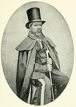 King Moshoeshoe Image source
Secondly the Griqua, who lived further west of the Basotho kingdom, wanted more land in order to farm merino sheep. Thirdly the Tlokwa under Sikonyela and the Barolong under Moroka also wanted to lay claim to parts of land under Basotho jurisdiction. Moshoeshoe wanted to prevent trekker control over land of his kingdom, but he knew that his kingdom was not strong enough to fight off the trekkers.
Thus in 1843, he signed a treaty with the British governor of the Cape. The British agreed to a border for the Sotho kingdom which would demarcate the Caledon River Valley as part of the Basotho kingdom. Yet in order to stop the disruption of trade routes caused by conflict between the Basotho and the trekkers, the British became involved in the conflict and claimed control of the area in 1848. The area was then called the Orange River Sovereignty. The British takeover led to conflict between the Basotho and the British and the Sotho defeated the British twice.
Despite the treaty between the British and the Basotho, the British gave control of the area to the trekkers at the Bloemfontein Convention of 1854. The Convention resulted in the demarcation of new borders in favour of the trekkers which included land that was part of the Basotho kingdom. Subsequently some Basotho raided cattle from Boer farms in the Caledon River valley which resulted in wars between the Orange Free State and the Basotho. The Sotho won most of the battles, but the Boers became stronger as they had the advantage of guns.
The British sold guns to the trekkers, but would not sell to the Basotho. Moshoeshoe made peace with the fact that the only way for the Basotho to keep any of their land was if they requested protection by the British. In 1868 Moshoeshoe made an agreement with the British that the Basotho kingdom would become a British colony called Basotholand. In 1870 Moshoeshoe died. Even though the Basotho kingdom became a British colony, Moshoeshoe was still able to save it from trekker takeover. Basotholand did not become a part of South Africa, but gained independence from Britain in 1966 and was called Lesotho.
Interior: expansion of southern Tswana chiefdoms
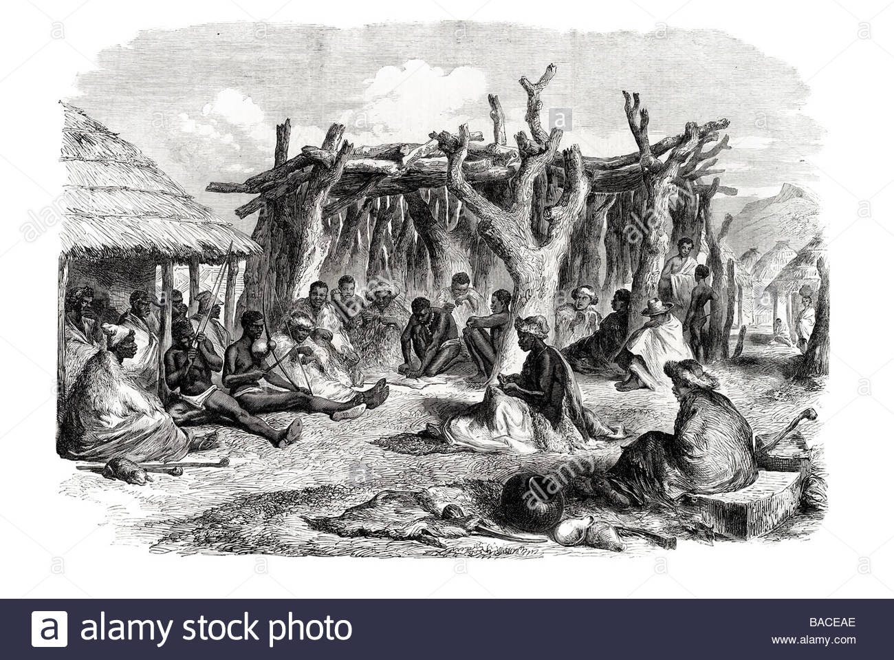 A Tswana group at a kraal near the Vaal River. Image source
Tswana Chiefdom
Chiefdoms that resided between the Vaal River and the Kalahari Desert were referred to as southern Tswana chiefdom. These Tswana chiefdoms included the Barolong, Bafokeng, Bahurutshe, Bakgatla and Bakwena. At the time there was increasing tension between these groups and historians argue different theories to justify the causes of the tension. Some historians argue that there was increasing conflict due to the changing patterns of rainfall which led to conflict over land. Archaeologists found evidence of high rainfall in the region in the 1750s which resulted in large yields of maize production and more grazing land for livestock. As a result of the prosperous farming, the Tswana kingdom grew.
However, after some years the rainfall patterns dropped significantly and subsequently there were food shortages and competition over fertile land. Conflict ensued within the southern Tswana chiefdoms and some of the chiefdoms expanded to other areas within southern Africa. A second theory is provided by historians who argue that the result of conflict is as a result of increased trade between the Tswana and other regions. Archaeologists found beads and cowrie shells in Tswana sites which came from Portuguese and Muslim traders on the Indian Ocean coast
The Tswana also bought horses and artillery from Khoi who resided in the Cape Colony and in return the Tswana provided animal skins, copper and ivory. Some chiefs became increasingly wealthy due to their control of such trade links which resulted in conflict with other Tswana chiefdoms.A third theory argues that cattleraidsfrom the south affected Tswana chiefdoms. The expansion of the Cape Colony affected the Khoi and San communities and as a result they raided the Tswana communities in search of food.
There were instances where deserters and runaway slaves accompanied the Khoi and San on raids. The deserters were equipped with guns and horses. The Koraor Korana (a nomadic Khoi group) and the Griquas (who descended from a mixture of Khoi and European groups) raided Tswana chiefdoms and attacked them along the Orange and Vaal Rivers. Settlers from the Cape also raided the Tswana chiefdoms in search of San women andchildren to work on their farms in the Cape. As a result of the raids, the region occupied by the southern Tswana became unstable. However, some chiefdoms became more powerful as they expanded. The Bangweketse, located in the north-west region (between the Vaal River and the Kalahari Desert) was one such chiefdom which expanded.
The Bangweketse chiefdom, ruled by Makaba (ca. 1790-1824), expanded as it took control of the Barolong. The Bahurutshe resided near what is today known as Tshwane (or Pretoria) and were the most powerful Tswana chiefdom. The centre of theBahurutshe chiefdom was Kaditshwene and it had a population of approximately 15 000 by 1820. Kaditshwene was the same size as Cape Town at the time. It was made up of fortified towns which protected the people and trade.
In the east: the rise of the Ndwandwe kingdom under Zwide
Chiefdoms also expanded between the Drakensberg Mountains and the Indian Ocean coast. The Ndwandwe, Mthethwa and Ngwane emerged as powerful chiefdoms in the region. Oral history has recorded evidence of conflict and competition between the chiefdoms. The Ndwande and Mthethwa were particularly powerful as they controlled large kingdoms south of Delagoa Bay (now known as the city of Maputo which is located in Mozambique).
The Mthethwa and the Ndwandwe grew more powerful as they controlled the amabutho – groups of young men who were soldiers and also hunted elephant for ivory in large regiments. Chiefs provided the men of the amabuthowith land and wives in order to set up their own homesteads.Conflict was as a result of various causes including population that growth placed major pressure on resources such as land, cattle and food. Another cause was a drought which started in the region led to competition for cattle and food, and the chiefdoms competed for control of over trade links with Delagoa Bay.The Ndwandwe were most powerful under the leadership of Zwide, who ruled from 1805.
Zwide made use of his amabuthoto conquer smaller chiefdoms in the region. Mthethwa, under the rule of Dingiswayo, was Zwide’s main rival. In 1817 Zwide ordered an attack on the Mthethwa and successfully defeated them, capturing and killing Dingiswayo. As a result of the defeat, the Ndwandwe became the most powerful chiefdom in the region.

